Numerous studies have shown the physical and mental health benefits of being outside, specifically in a less urban environment.
Nature prescription programs, or written directives from healthcare professionals to visit natural settings, are becoming increasingly popular. Spending as little as two hours per week in nature is linked to improved mental health and mood, physical wellness and lower levels of stress.
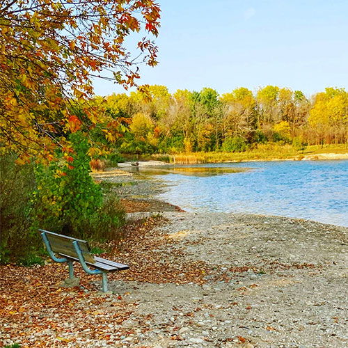
Below is a list of trails in and around our campus communities. These trails vary in length and distance from campus, but all are worth a visit. Grab your headphones – listen to music or a podcast – and explore your region. You’ll likely feel better for it!
We've rounded up some of the many trails, but feel free to check out other trails in Kitchener and trails in Waterloo.
Waterloo and Kitchener
Distance from Waterloo campus: Less than 1 km (you can enter the trail at Waterloo Park)
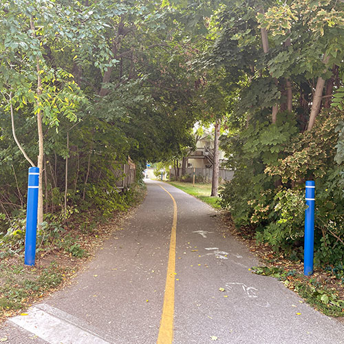
A paved, flat path that runs from north Waterloo, through Waterloo Park, into Kitchener and Victoria Park – and further south (Ottawa Street) if desired. Great for walking, running, biking and rollerblading.
The path seems to end at Waterloo Park, but simply head down Caroline St. S, turn right on William St. W. and then take a quick left at Park Street; the path begins on the right-hand side of Park Street. The full Iron Horse Trail is about 5.5 km, but additional distance can be added by walking through Victoria Park.
Tip: Enjoy the full loop around Victoria Park. See the swans while enjoying a stroll around the water.

Waterloo (Part of the University of Waterloo Environmental Reserve)
Distance from Waterloo campus: 1-2 km
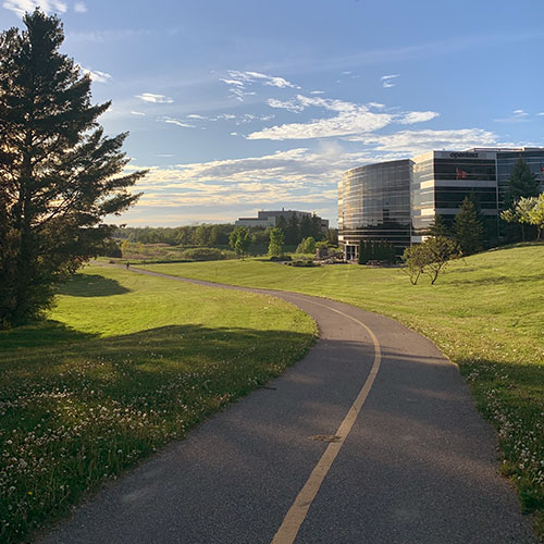
The Columbia Lake Trail is great for walking, running and biking. The distance around the loop is approximately 4 km. Half of the loop is through a forest and past Columbia Lake, the other half is on Westmount Road. The path is primarily made of gravel, and you will pass a beautiful creek.
Tip: Take a friend and go around sunset. The creek is especially beautiful as the sun is setting. This is also a perfect (and flat) loop if you’re planning on using a running app to track a run.
Waterloo and Kitchener
Distance from Waterloo campus: 1-2 km
The Spur Line Trail runs between Ahrens Street West (north of Kitchener’s downtown) to the uptown core of Waterloo, where it meets the Laurel Trail.
For Waterloo campus students, there is an easy access point on Weber Street near the Bridgeport Plaza. The trail – approximately 2.4-km long – is paved, flat and great for walking, running, biking and rollerblading.
Tip: Be prepared to see some geese, especially behind the Bridgeport Plaza.
On the Walter Bean Grand River Trail (access off Riverbend Drive), Kitchener
Distance from Waterloo campus: About 5km
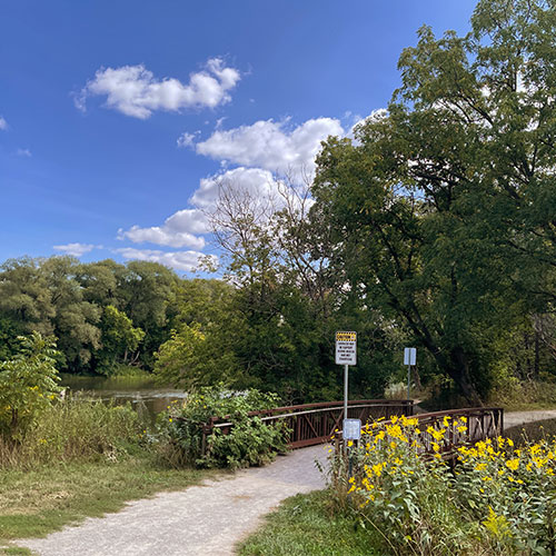
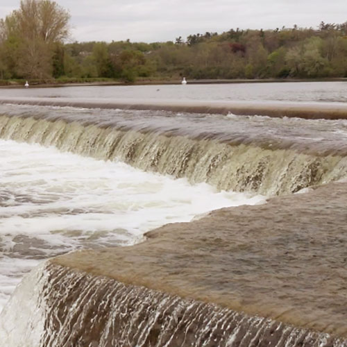
This trail is a beautiful hidden gem along the Grand River and offers lots of shade. You’ll feel like you’ve left the city and are fully immersed in nature. Start at Riverbend Drive and end your hike at Bingemans. The path is hilly, through the forest and along the Grand River. The path takes you behind the Kitchener Waterloo Humane Society and you can often see volunteers walking dogs. Great for hiking, running and biking. The full Walter Bean trail is more than 16 km.
Tip: Take lots of photos. This trail is especially photogenic near the water. It’s also a popular bird-watching spot.
594 Sundew Dr., Waterloo (can also access via Laurelwood Drive)
Distance from Waterloo campus: 8 km
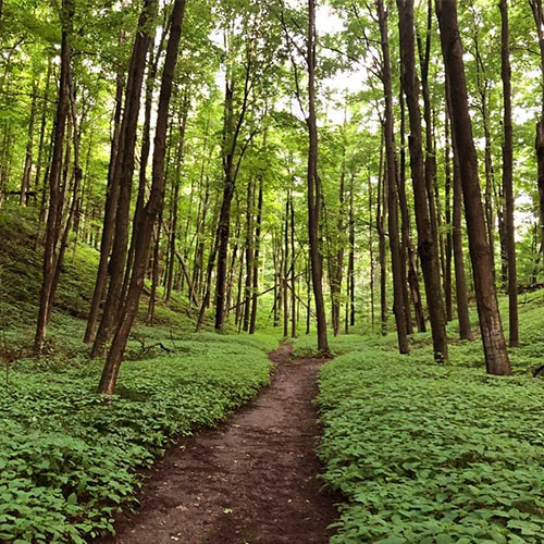
Westside Trails Loop includes hills and some gravel sections but is primarily through a forest. The trail includes well-marked signage and many side trails. Great for walking, running and mountain biking. The trail is 4.7 km, but there are approximately 12 km of paths nearby.
Tip: Take a deep breath and inhale all of that oxygen coming from the trees – and bring bug spray in the evening.
Near Bloomingdale (east of Kitchener)
Distance from Waterloo campus: 11 km
Snyder's Flats is a 100-hectare former gravel pit that has been restored as a natural area with ponds, new forests and grasslands. It includes a 4.5-km looped trail. It is a popular spot to brings kids and dogs (but make sure they’re leashed!). Parking is available and picnics are encouraged.
Did you know that Brantford is known as "The Hub of Ontario Trails" because so many trails converge in the city? Here are a few options you might want to explore.
Distance from Brantford campus: about 3 km
The Gilkison Flats Trail runs primarily between the Grand River and Gilkison Street and is great for walking, running or biking. Much of the 5.5-km loop is paved and there are small off-shoot trails that allow you to adventure through Fordview Park and Gilkison Flats.
If you’re hiking or biking along the Grand River in Brantford, make sure to pass by the TH&B Crossing Bridge and marvel at Wilfrid Laurier University’s contribution to the City of Brantford’s latest public art project. The TH&B Crossing Bridge is part of the City of Brantford trail network, connecting Gordon Glaves Memorial Pathway on the east side of the river to Gilkison Flats Trail on the west side.
Tip: With warm up and cool down, this is the perfect distance to work on your 5-km running time.
Distance from Brantford campus: 3 km (western access point is at Wilkes Dam in Brantford)
The SC Johnson trail runs from Wilkes Dam in Brantford to Country Road 51 in Paris and is approximately 14 km. The trail is finished with stone and provides an easy ride for bikers and a smooth path for walkers, hikers and runners. The full trail is a bit more of a hike (pun intended) than some of the other options, but will provide a nice challenge, especially if you’re a distance runner.
Fun Fact: The SC Johnson Trail connects to the Gordon Glaves Memorial Pathway system, steps from the Brantford campus, which provides a link to the GRCA's Hamilton to Brantford Rail Trail. The result is one continuous 77-km trail from Cambridge to Hamilton.
Tip: Close to the end of the trail (at the 44-km mark), a scenic vista overlooks a large oxbow on the Grand River.
Distance from Brantford campus: 3.5 km (via Colborne Street West)
The D'Aubigny trail is a popular site for birding, cross-country skiing, hiking and dog walking. The trail is more than 6 km. The first section is paved and the second section is gravel. It includes three bridges over three creeks and scenic views of the Grand River. It’s the perfect way to escape the hustle and bustle of everyday life but still be close to campus.
Tip: If you’re looking for solitude, go during the day.
Looking for more? Explore your options for adventure at discoverbrantford.ca.
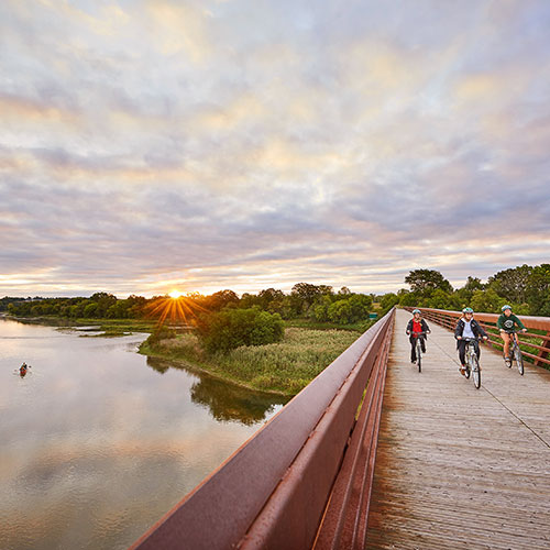
Photo credit: Mark Burnham.